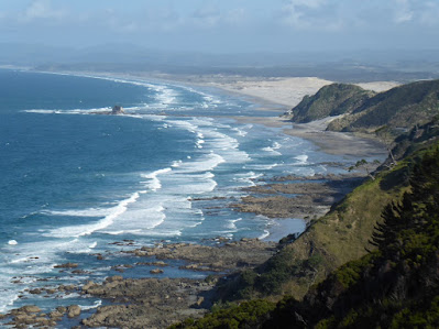
The next day was a driving day, up the left side of the Firth of Thames, past The City, Auckland, some provisioning on its north side, and then further north to a holiday park just short of Mangawhai, still on the Pacific side. And the next day, March 20th, we did the Mangawhai Cliffs walk. We'd done a bit of the beach part in 2014, but wanted to do it all this time. It's an 8km hike, half on the low-tide beach, then the return half on the "cliffs" above. The beach part, after a kilometer or two, changed into rocky volcanic out-crops, very jagged, then coves, then fascinating basaltic (?) columns like the Giant's Causeway in Northern Ireland, then coves, and then a giant pebble beach, and coves. Not easy footing, much of it. Then, finally, the arch that marks the end of the beach bit, and the 200+ steps up the hill ("cliff") for the high walk back. And the 200+ steps back down to the sand beach. It was the longest walk we'd done in a while, and by the end of the day we were fairly fatigued.
 |
| At the River Holiday Park |
 |
| Looking north, beach and cliffs |
 |
| And back to the starting point |
 |
| Islands, sea stack |
 |
| Shell shard city |
 |
This large bird--a spotted swivel-head--and I nearly collided,
scaring the bejeebies out of both of us |
 |
| Jagged volcanic stuff, A'a, not pahoehoe |
 |
| Flotsam, jetsam |
 |
| Pohutukawas cascading down from the hill (cliff) |
 |
| Tidal pools |
 |
| Organisms in tidal pool (micro shrimp?) |
 |
| More lava |
 |
| And then, Vicki cries out "Giant's Causeway!" |
 |
| Not exactly, but close; I wish I'd studied harder in Geology 101 |
 |
| Going on |
 |
| And then eroding in the waves |
 |
| And then come the football and basketball size pebbles |
 |
| Lots of them |
 |
| Plenty to look at when you're not minding your footing |


