Wednesday, July 28, 2010

Grossglockner

Our next Alpine goal was the Grossglockner, Austria's big mountain, in the Hoch Tauern and the Tauern National Park there. We drove to Heiligenblut and stayed there in the same campground we stayed at with Rachel and Rebecca in 1989. Heiligenblut has not changed a lot. It was still raining, as in 1989, torrents, with very dim prospects of actually seeing the mountain the next day. We never really saw it in 1989. I do not know what micro-climatic feature makes this mountain and its weather so nasty.
Up on the Hohenalpenstrasse, the high alpine road, part of
which shoots over to the Grossglockner; looking back 
toward Heiligenblut


The Kaiser Franz Josef high place--visitor center,
restaurants, cafes, a 5-story parking garage


Us at the RV parking lot; the weather steadily improved for
a couple hours


The Grossglockner's major glacier, one of the largest in
the Alps


And, finally, a good look at the summit


I took one of the trails, the Gambrubeweg, I think, which
went through six tunnels before emerging on the side of
the adjacent mountain, the Fuchserl, I think; this is a water
chime...drops of water from above create a random sort of
melody


Complete view of the glacer and the summit, and also the
wand; although only 12,000 feet or so, it's a serious
mountain


After an hour's walk, I was rewarded with this display on
the birth of the Austrian National Park system, due to a 
man named Albert Wirth, who visited Yellowstone (the first
national park) in 1899 and came back to Austria with a
dream; he is pictured with John Muir; damn, I was proud...


Love the signage


Ditto


Click to enlarge and see people on the glacier below...
probably not very smart people


Anyhow, we finally got to see the Grossglockner. Did I mention that the temperatures were in the high 30s and it was snowing the whole time we were up there. What happened to summer?!

We drove on, through nearly the worst white-out I have seen, and then through more torrential rain, into the Salzkammergut, and stopped at an aire near Bad Aussee. G'day, mate!

Strada della Dolomiti, parto secundo

From our aire, the next morning, after a walk, we drove on through Cortina and then back north, leisurely, in the direction of Austria.
A walk near the clouds


Distant crags


And not so distant


Features almost like the American southwest


And more like the Alps


A popular hiking valley in the national park


It turned into a cloudy day, but no less exhiliarating


More clouds moving in


Italian Park Rangers, enforcement-types (note side-arms)


This whole part of Italy was earlier part of the Austrian
empire--till 1919--Mussolini did his best to Italianize the
place, but it is still bilingual...the rangers above spoke
German

Strada della Dolomiti

Italy owns parts of the Alps' greatest mountains, Monte Bianco, Monte Rosa, Monte Cervino, all in the northwest. In the northeast are the Dolomites: generally lower, not glaciated, formed more by wind and rain than other things. They are extremely picturesque, however, something no mountain aesthete could pass up. From the Brenner Pass we drove on to Bolzano, a nice-enough looking small city, but with no obvious parking for RVs, so we headed straight-on, up ever-climbing roads, generally east, to the Strada della Dolomiti, which we followed a good number of miles. It was serious mountain driving, however.
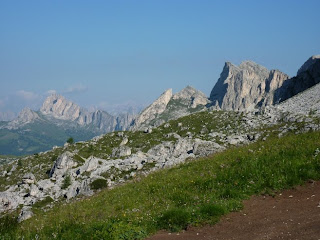
Peaks and crags everywhere, much limestone


In a small town


Tower on a larger mini-massif


And other features too


Back down in a valley, before heading up to Cortina


I am not sure whether it is boasting or serious road
information, but they number the hair-pin turns on these
roads


The road to the Pass Giua had 28 such hair-pins; the roads
are good, however, nice and wide; no tour busses up here


We found an aire, of sorts, just beyond this peak, and
stopped for the night


Other views in the vicinity


Parked at our "aire"


Table with a view: tomatoes and mozzarella and veal
piccata


The view

Sunday, July 25, 2010

Brenner Pass

After Zugspitze, we took the Brenner Pass back down into (very nearby) Italy, to see the Dolomite Alps
Our campsite, a Tyrolean lay-by, en route to Brenner Pass


Mountains on the Brenner Pass


The Pass is littered with old fortresses, to guard the pass,
and to charge tolls...nowadays, a mere 8 euros


Another

Descent of Zugspitze

Alas, as on Pilatus, part of the deal was walking the long trail down, this time nearly 6,000 feet, into Germany, then across a pass, and another, into Austria, and Ehrwald, and back to the campground where we had parked
Rugged little flowers in the glacial moraine


The trail signage was minimal...for the longest time I did
not know whether I was walking down into Germany or
across over into Austria


Looking back up to the summit area


Sheep eating snow


Finally, the Munich Alpine Club's Knorrhutte, where I
had lunch


And saw a sign


And a couple of sumo climbers


And some German bathroom humor


A last look toward the summit


The German/Austrian border, at 7,000 feet


Trail down the Austrian side, more
iron-mongery


More of the Austrian side


And a last cable-car to the bus, and to the campground,
weary...