Tuesday, November 3, 2015

Arches National Park, III: Landscape Arch

The most impressive of Arches NP's arches, I think, is Landscape Arch, not only its great size and length but also its position and delicate nature. At 290 feet, it is the world's longest natural stone span.
For much of our time in the Arches/Moab/Canyonlands area, we camped like 
regular Red Rock troopers, out on the desert, in the dispersed camping area along 
Willow Springs road, off route 191


Moon sighting along the trail to Landscape Arch


Us, with Landscape Arch behind us


Closer up


Standard view; almost the length of a football field


The trail not taken: a "primitive" trail went on beyond Landscape Arch


Neither of us felt like the trail's exposure...


Environs


The Double O arch, near Landscape

Monday, November 2, 2015

Arches National Park, II: Park Avenue

Next day, among other explorations in Moab, we hiked the short Park Avenue trail in Arches, so-called because the high walls on either side reminded early non-native visitors of Manhattan's tall buildings. Evidently the sun was getting to them.
It's just a mile or so that short-cuts a bend in the Park road


But the scenery is exemplary 


Thus; we saw The Martian a few weeks ago, and walking
around here it is so nice to see some green now and then to
remind us we are not on an EVA on the red planet


Yes, that's Balanced Rock in the far distant
right


The Three Gossips: Moe, Larry and Curly


More typical Canyonlands vistas


The micro is just as interesting as the macro; most of this
sandstone was put down as part of water action, seas, lakes,
rivers, streams, beaches, shores, over a 300 million year period;
fascinating to look at the record of wave and other action
recorded in the rock


Thus, ditto


Nature imitates art...origin of flame stitch, which some of us
associate with the American southwest...actually, it is thought
to be Hungarian, by way of Florence, and is known in the
needle-point world as "Bargello," which really Thai's things
together for me; impressed, Tawana? Thank you, again,
Wikipedia


Incipient arch...give it another 10 million years...


Morning Glory Natural Bridge

After our first day's exploration of Arches NP we drove into Moab to look around and to get some fuel. In this part of the world you want to keep the fuel guage on the full side. We then drove up the Colorado River a few miles, looking for sites in the several BLM campgrounds thereabouts and finally found one. After some further reconnaissance, we decided next day we would do the unfortunately named "Negro Bill" trail up a big side canyon to see the Morning Glory Natural Bridge, at 243 feet, the fifth longest rock span in the US. "Negro Bill" was Bill Granstaff, who settled in the area in 1877. Why not just call it the "Granstaff Trail" we wondered, but the snarky lady at the TI in Moab later informed us it was "part of our history" and would not be changed. It could be worse, I suppose.
Camped just down from the side canyon and the
next day's trail


The Colorado River, from our campsite; hmmm, looks tame
enough here...


Big walls all around


Starting up the trail


Ditto; interestingly, the sandstone on this side of the river is
not nearly so red as on the other side


Some of the walls were in the thousand foot range, I'd guess


Caves and such along the 2 mile trail


The little creek that the trail mostly followed--and crossed 11
times!


Hard to get lost in a box canyon


A great trail, despite the 11 crossings


First view of Morning Glory


Up closer; 243 feet span


So people often ask me, "Mark, what's the
difference between a natural bridge and a
natural arch?" The difference is that a natural
bridge is caused largely by stream erosion, and
tends to be flatter on top; in the little seep and
crack above you can see what is left of stream
action today


Back in the cave behind Morning Glory


Nice hike, nice feature, and thank you for waterproof boots

Sunday, November 1, 2015

Arches National Park, I

After leaving Montana--camping last at Clark Canyon--we drove on south, spending a bit of time in northern Utah to find some camper parts, but eventually on further still to the Canyonlands region in southeastern Utah, arriving Monday night and parking out in the boonies north of Moab, near the Willow Springs road. Lots of dispersed camping there, as the forest service calls it. Our first day in the region we spent simply exploring Arches National Park. We'd been there before, in 1990, but our memories were few and faint. We're planning to spend a month or more in Utah's pretty incredible array of national parks, monuments, and other entities. I've never had a taste for desert landscapes, but it's definitely growing.
Vicki, Rebecca, and Rachel under one of the Windows arches
in 1990


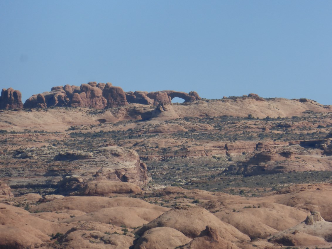
So anyhow here we are in Arches NP, 2015, looking across a
landscape of petrified dunes... 


The Lasal mountains, some over 12,000 feet, forming a distant
southeastern backdrop


Balanced Rock, one of the park's major non-arch sights...more
of it later


Hiking around in the Windows section, Double Arch


Click to enlarge; this will be on the quiz


North and South Windows


Turret Arch


Vicki on the hike


Canyon vista


A bit of the Fiery Furnace, which I hiked later in the week


Cairn cult, nearby


Balanced Rock, again, with Balanced Mini-Me
Rock in background left


Sometimes a pinnacle is just a pinnacle


Pretty neat place that we look forward to exploring further

Sunday, October 25, 2015

Camas Creek Ranch

On our way out of Montana we visited long-time friends Jamie and Jock at their Camas Creek Ranch near White Sulphur Springs. Jamie was chair of the Humanities Montana board that hired me in 1995. She went on to far, far greater things: after serving on and chairing the board of the Federation of State Humanities Councils, she was appointed by the President and confirmed by the Senate to the National Council on the Humanities, on which she still serves. She also served a term or two as county commissioner and as co-chair of the state Republican party. Back in saner times...
Thus


And thus, their beautiful ranch home; the great writer Ivan Doig lived in the
house for a time in his youth


"Meagher County Convention Center" (they entertain and host meetings, a lot)
and fire pit (site, in 1998, of the largest bonfire I have seen, at least since Westcott
Hall burned down in, what? 1969?, in Tallahassee); also their RV, a nicely-
converted and modernized Montana shepherd's covered wagon


Jamie and me, 20 years later


Vicki was feeling adventurous, so we took the back way out of the  valley, across
the Big Belt Mountains, through Confederate Gulch, an 1860s gold rush site,
Montana's greatest placer strike, found by paroled Confederate soldiers; in the
later 1860s, a third of Montana's population was in the Gulch


Not going strong, but still going


Emerging, not unscathed, from the Gulch, with a view of Canyon Ferry Lake


Mountains, south of Butte, en route to I-15 and the way south;
we'll be back to Montana in January...