Saturday, October 23, 2010

Patience of Job

At length, we figured out that TomTom's spelling of Turkish place-names is not always the same as Turkey's, and, without much further ado, having made the relevant adjustments, we made our way straightforwardly into Sanliurfa, to see the Abrahamic and other sites. First up was the Cave of Job. I'll let the signage do the explaining.
This is the kind of signage we are working with, although,
most times, it gets better; "and in English too"


Staircase down to the Cave of Job


Cave of Job


Kiosk above Cave of Job; note curious
bystander


Promised explanatory signage


There is a mosque by the Cave of Job, and a beautiful
garden


Job's Well signage


The Well


The Mosque


Interior


Glass


Me getting sprinkled by water from the well of the cave of
Job; we would have lingered but were impatient to get on to
the Abrahamic sites

Friday, October 22, 2010

Harran

Driving south now, in the Fertile Crescent, toward Syria (we got as far as the border town of Akcakale; we had no Syrian visae; but someday I really do want to see Petra, in nearby Jordan), we had planned on visiting the Abrahamaic sites in Sanliurfa, then driving on to further such sites in Harran. We had some navigational and linguistic problems in Sanliurfa, ended up walking around the downtown a bit, dropping by the archaeological museum, but we were not where we wanted to be, nor did we have any reasonable clues about getting there. Or parking, etc. So we resolved to drive on to smaller and more manageable Harran, see it, and regroup. Harran is mentioned in the Bible. It is the place where Abraham and his brood were living when God commanded him to go forth and find Canaan; and establish a new people; etc. Harran has a few interesting sites, but it is a rather squalid place, and, were I Abraham, I would have sought new digs anyway.
In the garden of the archaeological museum
in Sanliurfa; lots of Hittite and even
neolithic stuff


Castle ruins in Harran; 7th-8th century, renovated several
times; the Mongols sacked Harran in the 13th century and
laid waste everything


The mound at the top of the old city, the oldest part, now a
huge dig, all fenced off


Of course, in this part of the world, there are mounds all over
the place; no indication of significance, whether they have
been excavated...


Just down from the old city mound are the ruins of the
Grand Mosque, the first mosque built in Anatolia, 7th
century; the tower is one of Turkey's few square minarets;
all destroyed by those nasty Mongols


A small subdivision of the "beehive" houses for which
Harran also is known; actually, they are a relatively recent
architectural innovation (relatively speaking) 


In Harran, they are not just museum pieces; they do stay
cool, however, even on a 95 degree day like this one


Dog vs. brick wall


Cat marvels at dog's stupidity


We ended up spending the night outside the Harran
Culture House; 10YTL and another interesting "camping"
story

Crescent Fertile and Cotton King

In the 1980s, the Turks began implementing a plan (GAP) to dam the Tigris and Euphrates rivers, both of which rise in Turkey's mountains, for hydro-electric power and irrigation. Some two dozen dams have been built, thousands of square miles flooded, and some cultural treasures lost; but some found, as we'll see in Gaziantep. It is impressive to compare an irrigated field, in these parts, with an non-irrigated field next to it. Undoubtedly there has been much new employment and economic gain. The fertile crescent, at least this northern-most part of it, is fertile once again. Cotton is everywhere. And so we cruised along through southern Turkey, not Louisiana nor Texarkana, still hoping to find a Shorty's or a Sonny's or a Bubba's or some other BBQ, Vicki singing "Oh when those cotton balls get rotten/You can't pick you very much cotton/In them old cotton fields back home." I was still crooning "I left my heart in Nemrut Dagi."
The Ataturk Dam, on the Euphrates, near where we spent
Sunday night, at a sort of lay-by; said to be the world's 4th
largest


An irrigation canal in Harran


An irrigation channel and a green field of cotton behind it,
near Ackakale, on the Syrian border; everywhere, people
were out in the fields picking cotton

The roads were crammed with over-loaded trucks carrying
cotton to market


The highways themselves were cotton-lined as the stuff
blew out of the bags on the trucks; and there were gleaners,
apparently, picking up the loose stuff, re-bagging it, and
selling it on from highway stands with their own scales

Thursday, October 21, 2010

Nemrutland

Sunday we drove on to explore a bit of the valley west of Nemrut Dagi, the ruins of the Commagene capital of Arsameia, the 2nd century Roman Cendere Bridge, and the Karakus tumulus. From there we drove on, past Narince, where a major surprise awaited us.

Little remains of the Commagene capital at Arsemaia; they allied themselves 
with the Parthians and not the Romans; big mistake; here, a stele at the city 
entrance, high on a hill


What does remain is fairly great, however: this relief where 
the  Commagene king (Antiochus?) is shaking hands with the
patron god of Heracles; one sees this image elsewhere in the 
period, and it is frightfully close to some sort of divine right 
of kings idea


And this incredible stele about the founding of the city


Late bloomer


Remains of a Hellenistic city


Ditto


And, a few miles around the bend, the 2nd century Roman bridge over the 
Cendere River, a tributary of the Euphrates


Columns on the bridge


Karakus tumulus, across the valley from Nemrut Dagi; here the female royalty 
of the Commagenes were buried; the Romans plundered it for bridge-building 
materials


Eagle column at Karakus


Other columns, Commagene


Reservoir of the Euphrates


So after seeing all these wonderful sites, we were driving along, making good time, 
but dropping down to the level of the reservoir, when we suddenly found ourselves 
in line to get on the ferry; in this part of Turkey, with the various dams and 
reservoirs and hydro-electric projects, lots of roads have been replaced by ferries; 
upon examination, I determined this ferry was too small and that the seamanship
was dubious (they off-loaded and loaded without ever tying up); we decided to 
back-track 50 miles and stay on dry terra firma


Which took us back through Adiyaman (Ithink) and this interesting view of Turkish 
rug cleaning

Nemrut Dagi

Nemrut Dagi (the "g" is silent but indicates a separation between the vowels: we pronounced it "Nemroot Doggie" nonetheless) is a mountain in eastern Turkey, not particularly high, but above tree-line, upon which the 3rd century BCE Commagene ruler Antiochus built an over-sized setting of statues of the gods, himself included (hopefully). Not just a setting, but two, nearly identical, one facing east, one facing west. Antiochus was deeply into hedging his bets. Above the east and west terraces is a huge 150m artificial mound, which, presumably, contains the remains of Antiochus. Incredibly, the place was not "discovered," until 1881, nor excavated, partially, until 1995.  Over the millenia, earthquakes have tumbled the heads off their seated bodies, but they have been set aright, if not originally, then picuresquely. It is a fascinating place, especially considering the size of the statues and the height and remoteness of the site.

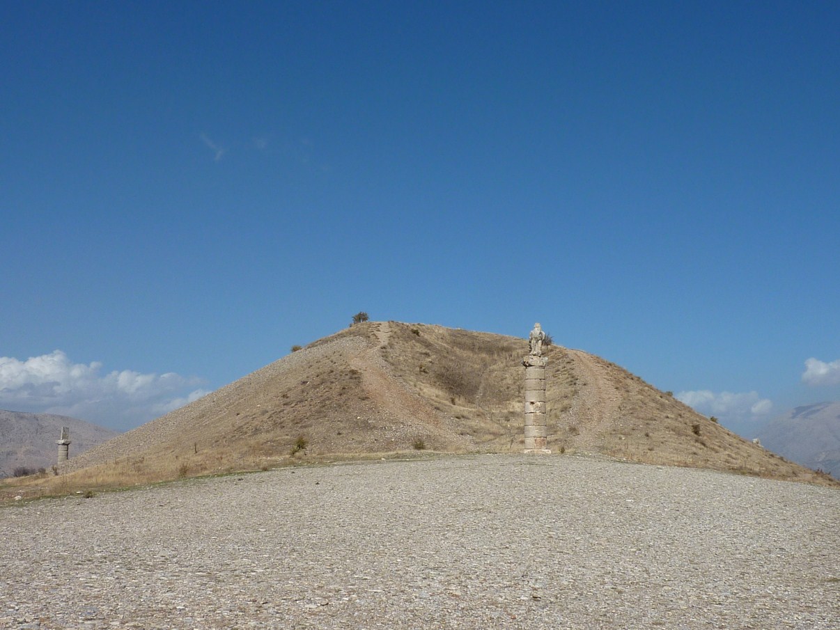
View of Nemrut Dagi; rather than subject the Grey Wanderer
to a high-angle uncertain road, we simply took the maxitaxi
up to the top; well, 600m from the top; the summit cone is
artificial


A view from the top (nearly); it is truly, truly, a harsh land,
all jagged limestone, even worse than what we saw in
southern Spain


A view of the eastern terrace; heads toppled from their
thrones, but set aright below


Me, conferring with the gods


Approximately 1/5 of the world's lady bug population lives
on Nemrut Dagi; seriously


The eastern terrace


Us on the western terrace


On the western terrace


"Hey, mister tambourine man, play a tune for
 me"


Bad leg, bad arm, but she photographs well,
and can go anywhere; and I love her