Tuesday, September 22, 2009

Black House

The Clearances also got to the Outer Hebrides, and all over the island are 
abandoned dry-stone dwellings, usually just the walls--black houses. When 
they got to using mortar, they became known as white houses. Anyhow, 
there are black houses on exhibit near Bragar, which we visited. Above, 
Vicki outside the black house; note netting, held down by stones, holding 
the thatch roof down.


Interior


Hearth--that is, peat coals burning in the middle of the floor --no chimney; 
easier to smoke fish that way...


Box beds


Of course, the animals lived under the same roof too

Doune Broch

Out on the west side of Lewis is a somewhat preserved
broch, Doune Broch, one of those circular, double-walled
towers the residents of Scotland put up in the Bronze Age
and thereafter. Sort of a predecessor to the tower houses, I
guess. Shaped, originally, like one of those nuclear reactor
cooling towers. Animals on the ground floor, etc. This one
was inhabited until the 1st century BC.


Doune Broch


Interior....beautiful dry stone work, here as at
other places


Interior staircase (that is, between the inner
and outer walls)

Callanish

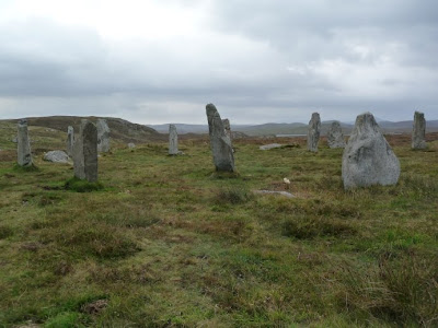
Callanish itself is a bit unusual...a cruciform shape has evolved, a couple long avenues, a circle, a ruined dolmen within the circle. Hundreds of years of use, re-use, changing perspectives and interests. Unlike some other major sites, the stones themselves, Lewissian schist, I think, are of interest as well.

Callanish evidently was visited by the 1st century BC Roman, Diodorus Siculus--much closer in time to us than Callanish's builders--who wrote "...beyond the land of the Celts there lies in the ocean an island...situated in the north...inhabited by the Hyperboreans...and there is both a magnificent sacred precinct...and a notable temple...spherical in shape ... The moon as viewed from this island appears to be but a little distance from the earth...and the god visits the island every nineteen years and...dances continuously through the night until the rising of the Pleiades." The site's orientation involves some of the local geography, the moon, and indeed one of the avenues points to the Pleiades (a celestial event).
Model of Callanish from visitor center...cruciform, avenues,
circle, etc.


Beautiful rock

View from the "natural" temple


Part of circle and transept


Vicki


Us


Callanish Satellites

Callanish, on Lewis/Harris, is another of those great megalithic centers, one or more main sites, many "satellite" sites, sometimes only hundreds of yards away, still being discovered and interpreted. Callanish had a long neolithic history but its builders seem mostly to have had lunar interests. All this c. 5,000 years old.

September 18 we awoke early. Our return reservation was for the 4PM sailing in the afternoon, but we were wait-listed for the Saturday sailing. They don't sail on Sunday. (This is a very Puritan sort-of place; the Sabbath is really, really sacred; seriously: fishing licenses do not permit Sunday fishing). So it was see Lewis/Harris in a day, or in three days. We drove north and then west, hurriedly, out to Callanish, our principal destination, and the Stones of Callanish there.

Central and southern Lewis/Harris is mountainous, but the northern part, where we were, is merely hilly and moorish, hundreds of miles of rock and heather and consequent thousands of years of peat bog, everything either Lewissian schist, beautiful striated and swirly rock, or squishy and spongy and purple, but also wind-blown, cold, and, in the larger view, pretty desolate. How many synonyms are there for “bleak”? There are some few trees down in Stormayer, mostly at its castle and grounds, the lord's former deer park, but none else on the island except for an up-start commercial conifer forest or two. And associated clear-cuts. As in Ireland and Denmark, and Orkney, everything was de-forested thousands of years ago. As Jared Diamond wondered about Easter Island, one wonders here, too, what were they thinking when they chopped down the very last tree?

Ceann Hulavig, about 2 miles from the main Callanish site


Vicki at Cnoc Ceann a'Gharraidh


Cnoc Fillibhear Bheag


Interesting stile joining the latter two properties...at the bottom, neolithic builders


Isle of Skye and Beyond

From our perch above Loch Carron we drove on to Lochalsh and then, after a serious blackberry-picking bout (with the usual disdainful response from the locals), we drove across the Skye Bridge to the fabled Isle of Skye, the first of the inner Hebrides off Scotland's west coast. (The Sky Bridge south of St. Petersburg, FL, USA, is more impressive, as a bridge, but it does not have the scenery one finds here (although the Gulf sunsets in FL are pretty unbeatable)). We stopped for fueling and information in Broadford. Here, Vicki ascertained that the only Drambuie site on the island was at the Broadford Hotel, where the Bonnie Prince gave the secret recipe to the Mackinnons. Drambuie, so she was told, is manufactured and bottled in Edinburgh. Secretly, I add. Too bad. They should have a distillery tour, even if they are not distilling anything. I would have gone.

She also found the costs and timetables for the ferry from Uig, the northern port of Skye, to Tarbert, the southern port on the Harris/Lewis Islands. Harris/Lewis is an interesting phenomenon. They are one island, but go, regionally, by different names. Harris has the tweed, Lewis has the chess set and the stones.

I had pretty much written off the Stones of Callanish as a destination too far and too costly. The Outer Hebrides? Maybe in another life. But, suddenly, they were within reach, just a two hour ferry ride away. We did all the calculations and determined to ferry the Grey Wanderer over, so we'd have a place to sleep, eat and means of travel, thus saving all those costs. (We should have done the same for the Orkneys). So we headed north, toward Uig, enjoying the Skye highland and costal scenery, with a detour, midway up the island, to the Talisker distillery.

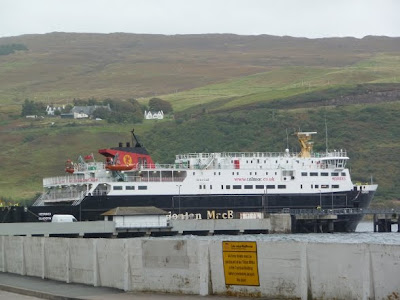
We proceeded on to Uig and the ferry, a big ferry, the MV Hebrides, 5,000 tons. Scottish ferries are far more formal than Norwegian ones. In Norway, you just queue up and drive on, buying a ticket from the guy/gal with the ticket-machine slung from his/her shoulder. No big thing. In Scotland, at least here, you go into an office, converse with someone at a counter (a very nice and informative person, in our case), who confers with a computer, buy your ticket, and receive a folder of documents. Then, as in Norway, you queue. From the staff  there we learned the interesting story of the merchant vessel Politician, which ran aground off the Isle of Eriskay during WWII with a cargo of some 250,000 bottles of Scotch bound for the US. The efforts of the thirsty locals versus the customs and excisemen to retrieve the cargo is the background of Compton MacKenzie's comedy novel Whiskey Galore, later a feature movie. Must check it out.

The voyage aboard the MV Hebrides was fine, scenic among the various Hebridean islands and skerries. We landed and drove off the ferry in Tarbert, South Harris Island, as the sun was setting. Forty miles up the dark road, half-way across the island, we found a suitable lay-by on a secondary (tertiary? quarternary?) road, by the finger of a loch, and spent the night, already feeling quite far out on an islandic limb. Lewis/Harris/whatever is really out there. The moon is very, very low at this latitude, and it was very, very dark. I longed for a bottle of Dark Island, but had to settle for Drambuie.

On the west of Skye, the Talisker Distillery, one of the
great ones


Our ferry, the MV Hebrides


Isles and skerries in the Little Minch, which separates Skye
and the outer islands


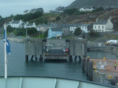
Cleared for landing, final approach to Tarbert...


Scottish Hunters

Pulling up next to us at some overlook was a party of four
well-attired Scottish hunters; note the threads on the guy in
the center; we couldn't figure out whether he was the lord/
earl/duke/viscount/whatever or merely the driver


They were towing this interesting device


All our Montana friends hunt in neck-ties, too

Western Highlands and Lochs

September 16 was a day of slow driving, with many stops, across the northwest Highlands and lochs, from Ullapool to the heights above Loch Carron, just short of Skye, where we presently are camped, at an incredible lay-by a couple hundred feet above the loch. Highlights included the gorge—deepest and thinnest I have ever seen—at Corrieshalloch, lunch at Little Gruinard Beach, Loche Ewe (Murmarnsk convoys), Loch Maree, and then finally, Loch Carron. Much of this was on one-lane roads, again, more crowded than yesterday, but not that bad. Everything was scenic—both the Highland and the lochs/firths, a beautiful almost too sunny day, warming to T-shirt weather. Dinner was, for Vicki, Tika Masala, and for me, after a Rusty Nail, of course, mixed seafood in a white Ricard sauce with rice, expresso, and then lemon sorbet. Life is very good indeed.

Little Guinard Beach, where we lunched


Loch Ewe; last refueling for the 600 ships that did the Murmansk Run in WWII; 
the pier is a NATO refueling site


Loch Maree


Mountains around Loch Maree


Lay-by overlooking Loch Carron


Mackay Country

Having seen enough of the coast, we cut inland on the Strathnaver Trail, which takes you up the beautiful Naver river and valley, past scores of landmarks, pre-historic and historic sites in Mackaydom. The most important of these we reached finally in the rain, the Grumbeg burial ground. Overlooking the river and then Loch Naver, this hilly site include a pre-Clearance and very old Mackay burial ground and the remains of a neolithic cairn/grave a few feet away. 6,000 years of Mackays! Despite the cold and rain, we clambered around and took a number of pix. If you could find a Mackay axis mundi, this would be it. Just down the road we also clipped some heather, to dry and save for Bobby and Marie and Rachel and Rebecca. Vicki's “roots” experience is nearly complete. I just hope she doesn't discover the McCoys are really part of the Clan MacGillicuddy.

We proceeded on, most of the day driving on one-lane country roads with passing turn-outs, averaging, oh, maybe 20mph. At length, after getting further inland, back into the Highlands, we turned west to the coast and made it nearly to Ullapool. The campground there wanted 16 quid just to park, which I regard as larcenous this time of year, so we backtracked to a layby higher up in the valley, before you get to the beautiful fiord, and parked there for another rough-camping night. After the B&B in Kirkwall and dinner, we need to economize still further. Not to mention my various HP souvenirs.
The beach at Bettyhill


Fishing on the Naver


Western Highlands


Loch Naver


Very old Mackay burial site


Vicki at the site


The ruined dolmen


Mackay Country


Extreme Recycling

The Scots are legendary for their frugality. Scotch whiskey is distilled only once, whereas Irish whiskey goes through the stills three different times. But at the Strathnaver Museum near Bettyhill, we encountered what has to be the ultimate in frugality, or at least in recycling. The object pictured below is a dog-skin buoy. Fido. According to the museum description:

“The rope was attached to the head end of the buoys and as the net filled with fish the rear end would bob up and down in the water. When the catch was a good one it gave rise to the saying: 'The dogs are fair dancin' today!'”

Now I call that inventive and yet another valuable lesson we can take from our ancestors. Next time you look at dear old Rover, realizing that he is aging seven times as fast as you are, think ahead to what useful purpose he might serve in his next, um, incarnation. Of course, if you are a commercial fisherman given to traditional methods, this is easy. But if not, then consider...pool toy? scuba-diving marker? helium-filled balloon (smaller dogs)? The possibilities are endless. Help save the earth!

Please do not report this blog to the SPCA.


North Coast

The north coast of Scotland is Mackay clan country, and home to Vicki, since she reckons McCoy to be a corruption of Mackay. Just ask a Scot to pronounce "Mackay" and you'll hear something much closer to "McCoy." "Mackay," here, rhymes with "sky." She even saw one source that included McCoy as a sept of Mackay, along with Stevenson, her maternal grandmother's name (which suggests the possibility of some kind of incest to me, but that is another story; fortunately, she does not read my blog).

The north coast is alternating beautiful broad golden sand beach and cliffs and heads. It was a less fine day, with mixed weather, but generally OK. We stopped at the Thurso Tesco for proivisions, then drove on to Bettyhill and the Strahnaver Museum. This is the main “Clearances” museum and also a Mackay museum, this being the heart of Mackay country. The museum was very much a county museum, just like in Montana—incredible stuff, humbly but sincerely displayed, with (volunteer?) staff to welcome you and answer every question. Despite being on the north coast of nowhere, cold and wet and deserted, there was a constant flow of visitors. Descendants of the Clearancees—when early 19th century Scottish “nobility” forced thousands of subsistence tenant-farmers off their lands, to make way for the more profitable sheep ranching--must now number in the millions. The exhibits told the terrible story, simply but effectively. True to human nature, the Sutherlands thought they were actually improving the lot of the 'savage and indolent' Highlanders. If you had to burn all the dwellings and posessions and kill a few tenants in the process, well, that was just a little more collateral damage. Perhaps the most astonishing find for us was a book called Gloomy Memories, by one Donald MacLeod—an account and condemnation of the Clearances and the Sutherlands, published much later, in response to Harriet Beecher Stowe's Sunny Memories, which treated the Sutherlands as bold social engineers (so we read). Must look into this.

Right on the coast


Just about every other headstone is a Mackay


Neolithic beaker, found in the vicinity


By order of the Queen (apparently
Highlanders threw rocks at the telegraphs)


Mackay crest and tartan (modern)


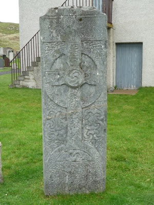
The Farr Stone, a Pictish stone in the cemetery,
7th or 8th century


Land's End

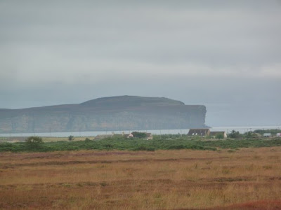
Dunnet Head, the real Land's End of Scotland and the
British Isle; didn't go there; after Nordkapp, we're
unimpressed


Seals at sunset on Gills Bay, between Dunnet and
John O' Groats

Further on down the road all the original fences are in big
slate slabs; this one with a charming but de-commissioned
nuclear reactor in the background


Orcadian Trees


Several Orcadians told us that trees could not survive on the Orkneys: too windy. There is a small forest in a hollow by a large farm, and another, higher up, down the road, a bit northwest of Kirkwall. Probably grown with great care. And there are a few older and larger trees downtown in Kirkwall, including one affectionately known as "The Tree." I prefer to believe the Orkneys were deforested, and can be reforested, by humans.