Sunday, July 26, 2009

Lofotens II

July 18 we continued our drive on the E10 up the Lofoten chain and its scenery, incredible even in windy, rainy, cloudy weather, stopping briefly in Svolvaer for email and shopping. Here we received the welcome news that our $14,000 “deposit” with the Germans had been refunded, as we requested upon leaving the EU, and wired to our US bank account. What a relief!

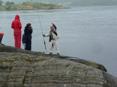
At another mini-maelstraum down the road I went fishing again with a new new lure (15NOK at Svolvaer Maritime Supply). I made a fine cast into the maelstraum, from bridge pilings between the two islandss...with high hopes. But, alas, the line was not attached to the reel (factory defect?) and my line and brand new lure disappeared into the turbulent depths. Fish 3, Mark 0. Perhaps I'll buy new line and lures in Scotland next month. We paid $15 for my rod and reel and set-up at the Kathmandu store in Auckland last December. The lures and line will exceed that. Is this what is meant by sunk costs?

As we drove further north in Lofotons, toward Narvik, the question arose of where we would go next. Our relatives in Brussels will be out of town when we pass through, so we have “gained” a day or two from there. At length, the northering instinct prevailed, and we decided to drive on to the North Cape, the Nordkapp, as Europeans call it, the northernmost point of Europe. It is a major destination, and we wanted our RV to display the same Nordkapp sticker we have seen on others. We had dinner at a rest area and drove and on, into the “night,” stopping about 10PM at yet another rest area.
View across the channel from our campsite, first night in Lofotens

Lunch first day

Fish racks and peaks, typical scenery

Ditto

Another village and mountain face

Arctic white sand beach; yes, there were people on the beach...

Another sand beach on the Atlantic side

Reconstruction of Viking chieftain's long house, built on original foundations

Arctic ferns

So many of the houses and other buildings have grass growing on  the roofs,
I have wondered how they mow it

Question answered!


Lofotens I

We arrived in Bodo late in the evening, ascertained that we would not be getting on the 10PM ferry, and so spent the night in the noisy ferry car park. Early the morning of the 17th we just missed the 4:30AM ferry but did make the 6AM ferry; perhaps not two dozen people and a dozen vehicles aboard. There were light swells once at sea (a long time, given the size of the harbor and number of skerries), and even the Norwegian sea was nearly glassy, like the fiords we have seen. It was an uneventful 4 hour cruise. We arrived at Moskenes, in the Lofoten islands, about 10 AM, visited the TI, and proceeded to drive the E10, the length of the islands, stopping frequently, sometimes every couple hundred meters, to look at and photgraph the incredible scenery here.

Norway's Atlantic coast consists of the fiords and of thousands upon thousands of islands. But, unlike what we saw in Sweden and Finland, the islands are not skerries, rising only enough to support a small forest or some summer homes. In Norway, they are mountains rising from the sea, and nowhere is this more dramatic than in the Lofoten chain of islands that spread west of northern Norway. The mountains are not high by any standard, but at this latitude—67 degrees and more—they have all the features of their larger alpine cousins: glaciers, peaks chiseled by glaciers, tarns, waterfalls, snow, and everywhere the sea, more fiords, more maelstraums, and so on. Add to this the fishing culture that has been going on here for aeons, since paleolithic times, the more recent cod and minke whale industries...it is a pretty fascinating place. With every bend in the road and sight, we commented that one could spend months here, hiking, climbing, walking beaches and fiords, and only scratch the surface. Well, summer months; although the mean winter temperature here is only -2 Celsius, probably very comparable to dear Missoula. That good old Gulf Stream at work again. But one suspects it never really warms up very much, and that the other 10 months are not so wonderful. We camped on a fiord again, in light rain, and 47 Fahrenheit outside. Still it's an incredibly neat place, well worth the 3 stars, and we have seen only half of it so far. Oh, we looked at our worn world map, and, to our surprise, discovered that we are relatively far to the north of even Iceland now.

Earlier in the day I bought a lure and went fisking again. Last time was a wash, but this time the fish won: I lost my 29 kroner souvenir lure to the rocks and weeds.
Our ferry, in the Moskenes harbor

Our first view, from a few miles out

The more southerly islands...no bridge to them

We decided to do the villages in alphabetical order; fortunately, A was at the
southern tip of Moskenes (OK, if you know your Norwegian alphabet, you know
that the superscripted letters come at the end)

Boats on a fiordlet

Skerries and peaks

Fish drying racks and peaks

More peaks

Fishing village on Moskenes

Village and peaks


Maelstraum

Just short of Bodo is the Saltstraumen Maelstraum. The fiord narrows to just 150 meters, and the tide rushes in and out 4 times daily, reaching 28 knots, 87 gazillion gallons or so. The current, whirlpools, etc., are impressive, as are the fisher-persons and sea gulls that gather for the fish feast. The whole area is dominated by a another huge, sleek, high Norwegian bridge.

A whirlpool at the Maelstraum; incredible current, depth, etc.

The seagulls feasted by the hundreds

It's evidently a great fishing hole

This guy was catching them two at a time, no kidding

Another sleek Norwegian bridge over it all

66 Degrees, 33 Minutes, Norway

Our drive north July 16 continued on to the Arctic Circle, 66°33', a major European destination. The terrain there is a higher, tree-less plain, about what one would expect for the Arctic Circle. There is a large visitor center and many commemorative monuments. After pix and shopping at the gift store, we drove on.

Our northering instinct was only encouraged by getting this far. We proceeded on to Bodo. Rather than turning back--we had originally not intended to go as far north as Trondheim--we had decided to do the Lofoton islands, another 3 star destination. I knew of them from my WWII reading--Lord Louis Mountbatten's Commandos conducted raids there in 1941--and the Michelin rated them very highly. Stunning, breath-taking, etc. Michelin was right.
Welcome to the Arctic Circle, farthest north we have been

Us at the official monument, in front of the visitor center

The monument text

Terrain

Our satnav was unimpressed

Ferries


Part of the queue to board, somewhere along RV17

The Grey Wanderer, first for take-off, after Tro (I had to back on)

Docked for the night

Another arrives

A water ambulance, at Tjotta

Ferries are a major part of commerce and culture here. The isolated islands and fiord communities often can not be reached without them. Everything revolves around their schedules.

More RV17


Mountains and skerries

Clouds roll over a ridge

More granite than I have ever seen

Twisted mountains

Among the Seven Sisters range

Rock Carvings at Tro

See the previous post for narrative on Tro and the carvings.

The red rock mountain stood out amid all the granite, for hours as we drove or sailed the ferries; it turned out to be Tro

Road less traveled; actually, it was about the only sign on the island

Location of the rock carvings, above this fiordlet on Tro

The Lillehammer skier

Fish

Seal

Moose; here they're called elk, or elg

All of this paleolithic, 5,000-10,000 years old.

RV17: Ferries, Skerries and Rock Art (oh my)

Our drive July 15 along the RV17 went faster than expected, aided in part by hitting the ferries just about exactly right. The day took us from Grong to Tjotta, with a major excursion to the island of Tro. In all, I think there were 4 ferry crossings—Holm to Venesund, Horn/Andalsvagen, Forvik to Tro, and Tro to Tjotta. The last two were major voyages, ferry-wise, 45 minutes in duration each.

In retrospect the excusion to Tro was one of the more iffy things we have done. We had read that one of the islands RV 17 passes by is Tro, where there are important paleolithic rock carvings, including the 10,000 year old skier that was the emblem of the Lillehammer Olympics. Tro was on the way, sort of, to our next destination, Tjotta, so we bought tickets on the ferry, drove right on, and looked forward to a 45minute voyage and to seeing some paleolithic good stuff a bit off the beaten path.

We began to get some idea of how far we were off the beaten path when we noticed we were the only party and vehicle getting off at Tro; that there were no ferry lines personnel to greet us or direct us, no kiosk, no signage, no pavement; no tourist information center, nobody wanting to sell us reindeer sausage and dried fiske. Nobody at all, as a matter of fact. Driving around a bit on gravel roads introduced us to a couple of joggers, two school-children, and, finally, a gentlemen who happily got in his car and led us to the trail-head, past two gates, which we never, ever, would have found or crossed on our own. Kindness of strangers, again.

The hike itself was a bit of an adventure....poorly signed originally, across fields, a ravine, a woods, finally, to the fiord off-shoot where the carvings lie. The carvings themselves were great. They had been covered for conservation, and we were the first of the season to see them. See pix.

We got back to the camper and then to the dock for the 8:00PM ferry to Tjotta with time to spare. We were very happy to see that ferry.

More on RV17 on succeeding posts.
Route 17, the Atlantic coast highway, a storied route in Norway

Granite, everywhere, mountains rising from the fiords and the sea
On one of the numerous, sleek, high, long, Norwegian bridges
on RV17


Inland valley view

Our campsite on Tjotta harbor

Subtle harbor signage