Sunday, January 21, 2018

Aoraki's Hooker Valley

Sunday dawned sunny and warm, and so we decided to do the Hooker Valley trail, often billed as New Zealand's finest day-hike, and therefore in the running for finest day-hike world-wide. As the fella says. The trail goes 5k up the valley to Hooker Lake, into which spills a glacier falling from Mt. Cook itself. On a good day, it would be hard to beat. The views of Mt. Cook as well as the glaciers hanging off Mt. Sefton are stupendous.
Not far down the trail, hanging glaciers and a tarn

Aoraki--Mt. Cook--at the head of the valley, its summit in the
clouds

Ever-interesting New Zealand clouds--at the intersection of the
maritime and the alpine, in the thick of the Roaring Forties
(latitude)

Imagine my surprise when I put my glasses back on...

At trail's end

Lake and glacier

Thus

A solitary iceberg at the end of the lake

Heading back...hanging glaciers


Vicki on one of the several suspension bridges

Looking back to Mt. Cook

The clouds have parted!

Affording a good view of the summit (right of center)

In the distance, now many miles from the mountain, Lake Pukaki

Back at our campsite, first use of our Nemo
shower...a success that will extend our feedom-
camping ways!

Approaching Mt. Cook

From Lake Tekapo we drove on to Mt. Cook village and the DOC White Horse campground there, where we would spend the next few nights.
After some miles, you round a bend and there, above Lake Pukaki,
wreathed in glaciers, is Mt. Cook, the greatest of the Southern Alps

Upper bits: what appears to be the summit, on the right, is actually
the beginning of a kilometer-long knife-edge leading to the summit,
the bump in the middle (click to enlarge)


Many glaciers emanate from Mt. Cook, most famously the Franz
Josef and Fox glaciers, on the west side; here, another descends
nearly to the valley floor

The White Horse campground sits below Mt. Sefton and a whole
line of hanging glaciers

Thus

Thus

And thus

All falling under enveloping clouds as the day proceeded; we'd
be marching right past them the next day as we hiked Hooker
Valley

Lake Tekapo And Ascent Of Mt. St. John

We proceeded on to the hamlet of Lake Tekapo, located at the south end of the immense and beautiful alpine lake, and spent the night at the holiday park there (Kiwi for campground). Unless you're a boatie, there is little to do here except walk the two block tourist area, rest, reorganize, do the wash, shower, and climb nearby Mt. St. John, all of which we did. Then you drive on toward Wanaka and Queenstown or up to Mt. Cook, which we also did. Interestingly, we stayed at this same holiday park in Lake Tekapo in 2014, almost the same day of the year, and it was 30 degrees F that night (in a tent!), with a gale the next morning. This time it was sunny and warm, temps in the 70s. Mt. St. John is a 300m climb with an university observatory and cafe on the summit.
Mt. St. John's, observatories, etc.

Rock love seat on the trail up Mt. St. John's

A bit of the observatory campus with the bigger Southern Alps
in the background

Looking up the expanse of Lake Tekapo

The village of Lake Tekapo

Your are here

Another big lake on the other side, looking toward Mt. Cook

Us, there

After the descent, and some provisioning at the excellent Four Square in Lake
Tekapo, we drove 15+k up the corrugated gravel east-side road--memories of
Namibia!--and free-camped by the lake


Thus


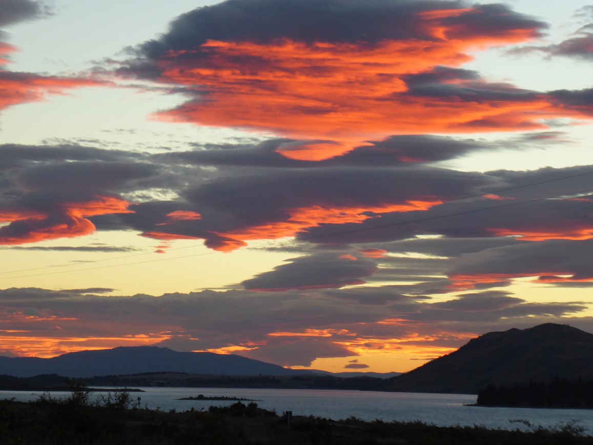
And enjoyed a great Kiwi sunset


It was a moon-less and nearly cloud-less night, and we stayed up well past our
usual bed-time to see the southern sky; alas, the photo does not at all convey what
we saw, pretty much the best night sky ever, for us

The Big Tree In Peel Forest

Not far from Arundel is Peel Forest, another DOC reserve, protecting an ancient stand of native trees. (Much of New Zealand, like everywhere else, was logged to near extinction in the latter 19th century). The place felt quite buggy (rain forest?), and we had misplaced our field guide to Gondwana flora (look it up), so we contented ourselves with a short walk to see the largest tree still standing on the South Island, an immense Totara.
It is known scientifically as "Big Tree"

Vicki stands for scale


Not all that tall, actually


Informative signage

Environs

The South Island has any number of deer and elk ranches; they
are raised for export of venison and elk meat (elkison?) to
Germany, where gamey meat is apparently prized; we passed dozens
of such ranches and here found one herd of elk close enough to shoot,
so to speak; in Montana, a scene like this would stop hearts


Rakaia Gorge, 2018

Our route toward Lake Tekapo took us past Rakaia Gorge, a bit of which we walked in 2014. This time, despite intermittent rain, we walked a bit more, although I can't say the views change or improve much. More impressive than the little gorge is the river itself, now in mid summer flow, carrying tons of glacial flour and other debris down from the big mountains to the west. After Rakaia, we shopped a bit in the pretty village of Methven and then carried on to a DOC campground named Arundel. Arundel was founded in 1067 by Roger de Montgomery, one of William's pals, and has for the past 900 years been the traditional stronghold of the Dukes of Norfolk. Wait; no....
Typical DOC signage; if nothing else, New Zealand is very well signed

The river

Massive old tree, undercut to hold two sizable shelters


Environs

Glacial flour


We walked on another 30 minutes or so

These two trees must have been oozing sap or something; both
were covered with buzzing
honey bees

Big sand and gravel beach

Rooby at Arundel; that's Vicki's yellow poncho drying out

Not a long white cloud, but just enough to catch a bit of rainbow from the west