Wednesday, February 7, 2018

Milford Sound, 2018

We rode out the storm February 1st, heavy rain beginning the evening before, then throughout the day and night and into the next morning. We've been to Milford Sound twice before--walking in 2009, and kayaking, and driving in and tenting and cruising in 2014--and we wanted to see it again, not merely because it's one of the world's great sights, but because of the waterfalls we figured would sprout up after the cyclone. There are glaciers and perennial snowfields all around, and scores of waterfalls from them, but after a heavy rain (we knew from 2009), scores more open up spectacularly, if briefly. So we undertook the 120k drive from Te Anau to Milford.
For the first 90k or so, it's mostly Lake Te Anau to look at, then, after the Divide
(and the western end of the Routeburn Track), things get alpine, interesting...


Waterfalls en route


More waterfalls; but, alas, these, and everything else we saw, are
perennials; as a Routeburn hut warden later explained, those
cloudburst waterfalls last just hours...and we were there the next day

Nonetheless, there was plenty to look at

The old, rough-cut, one-way, 1200m Hollyford Tunnel; still a thrill!


Alpine driving

More waterfalls

Valley


Iconic Milford view

Mitre Peak

The Sound and surroundings

Cruise boats and ships arriving/departing every few minutes


We thought we'd take a short lakeside walk...but the king tides were still in effect,
apparently

And we were soon driven back by water rising over the boardwalk!

The fiord suddenly became quite still and I got this wonderful shot (not!)


Headed back

We stopped briefly in Te Anau and then drove all the way to the lay-by on
Lake Wakitipu, near Kington, where'd we had lunched a few days before, and
stopped there for the night

Wednesday, January 31, 2018

Lakes Manapouri And Te Anau

En route to Te Anau on January 30th, we stopped by Lake Manapouri. In addition to the numerous fiords, Fiordland also contains two giant lakes, and many others, left by passing glaciers. Both Manapouri and Te Anau figure in a massive underground hydroelectric scheme, as we'll see. Anyhow, we stopped at the tourist center at Manapouri to see about replacing a T-shirt Vicki had acquired in 2014 during our Doubtful Sound cruise. We proceeded on then to Te Anau, hunkering down at the Top 10 Holiday Park, to let cyclone Fehi pass Wednesday and Thursday. The heavy rains didn't really start until later Wednesday night, and so, apart from walking the town and shopping, we also took a long walk along the lake at Te Anau, to the control gates (hydroelectric scheme) and back. And then we enjoyed the campground's hot tubs, with a lake view, that evening. And then the remnants of Fehi struck.
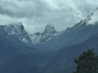
A bit of Lake Manapouri and its flanking mountains

The area, showing both fiords and the lakes; and the route of
the Doubtful Sound overnight cruise we did in 2014 (see
http://roadeveron.blogspot.co.nz/2014/02/doubtful-sound-1.html,
and http://roadeveron.blogspot.co.nz/2014/02/doubtful-sound-2.html)

Now on our walk on Lake Te Anau; in the distance, the "marble"
mountain at Manapouri, Mount Titiroa, a bit of a landmark


Mount Titiroa; it's really sand and a white granite

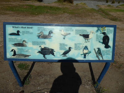
Near the DOC  visitor center on Lake Te Anau; further down
the trail is a major aviary we mostly skipped; next time; in any
case we learned there that the large, beautiful, pigeon-like bird
we encountered on the waterfalls walk was actually...a New
Zealand pigeon

Quentin McKinnon, who, along with partner
Ernest Mitchell, were the first Europeans to
walk on what is now the Milford Track


Looking across the lake to the Control Gates, which control
the flow of water from Lake Te Anau to Lake Manapouri
Thus, closer up; at Manapouri the water is diverted underground
to the power station, and then released into the Tasman Sea


Looking toward the Kepler range, where clouds and rain are
brewing...the Fiordland drought is about to end

At the Control Gates

Ventral view

Atop the Control Gates

Informative signage on the hydroelectric scheme, which
originally was about powering the aluminum plant in not-very-
nearby Bluff, but came to provide power for all Fiordland


Further ditto; click to enlarge

Rarely seen dorsal view of Lake Te Anau Control Gates

Something deeply evil is going on under this thick web

On the return, I identify Mt. Luxmore, in the center there; a week
or two ago we cancelled our Kepler Track reservations: the 2nd
day of the 4-day tramp included two very severe descents from
Mt. Luxmore to the Iris Burn hut, which, we figured, would not
be good for Vicki's knees; having done Luxmore twice already
(http://roadeveron.blogspot.co.nz/2009/02/kepler-tramp-high-
roadlow-road.html
and http://roadeveron.blogspot.co.nz/2014/02/
ascent-of-mt-luxmore-2014.html
) I was not disappointed; as it
turned out, we would have been on the Kepler January 31-
February 3rd, in the midst of the cyclone, when the whole route
was almost certainly closed anyway

The Lake Te Anau seaplanes and helicopters have already
departed in advance of the storm; back Saturday, the chalkboard
sign says 

Tuesday, January 30, 2018

Southern Coast, 2

After Curio Bay we turned about and drove back to Invercargill, stopping there to stimulate the local economy (another Kathmandu, Warehouse, E. Hayes, the famous hardware store, Countdown) and then proceeded westward along the coast, stopping at Cozy Nook and then spending the rest of the day and night at Monkey Island Beach. Next day, January 30th, we left the coast near Mackinnon's Rest, and headed north into Fiordland.
Hayes' hardware store; could well be the world's largest, as sometimes claimed;
I easily found the obscure bit of iron-mongery I had been looking for all the way
from Christchurch

Hayes is equally well-known as the resting place of Burt Munro's souped-up
1920 Indian, on which he set a world land speed record in the 50s, the subject
of an Anthony Hopkins film of note;Munro was an Invercargillian; Hayes' is
as much a museum of motorcycles and race cars and other curiosities as a
hardware store; Invercargill's other very famous resident is dealt with at:
http://roadeveron.blogspot.co.nz/2009/02/henry-tuatara.html


Could easily pass as scenery from Acadia National Park in Maine; but better


The southern coast is generally a windy place, but this day was relatively calm

Interesting house on the road to Monkey Island

Monkey Island Beach, as far as the eye can see

Monkey Island, at low tide; we walked out and climbed to its little
observation deck

Incredibly clear water

The beach; and cliffs; Monkey Island was so-called because of a monkey-winch
installed there to bring ships up onto the beach

We were not alone

Touring residence of a nice young Kiwi family; as students of this blog know,
such rigs are not uncommon in New Zealand, see http://roadeveron.blogspot.co.nz/
2014/02/kiwi-rvs-at-gypsy-fair.html for further, more lavish examples

Incoming tide, and Monkey Island is again an island; think: Mount St. Michel;
no, don't

Sunset on the beach and cliffs


Sunset on the beach

Our encampment; it's a "freedom" camping spot, and became quite crowded
as the evening progressed


Next morning, looking across the bay toward Fiordland

Pano of Monkey Island Beach (click to enlarge)

On down the road, at Mackinnon's Rest (ah, memories of '45, the Mackinnons
of Skye...rusty nails...)

Looking the other way, more miles of deserted beach; note the wind has picked
up, blowing hard toward the sea...Fiordland in the backgound

One of the more locally-oriented Kiwi signposts (usually they'll tell you the
distance to London, Tokyo, or New York)